
KEY POINT
- The wind advisory affecting Southern California is in effect Monday from 6 a.m. to 6 p.m.
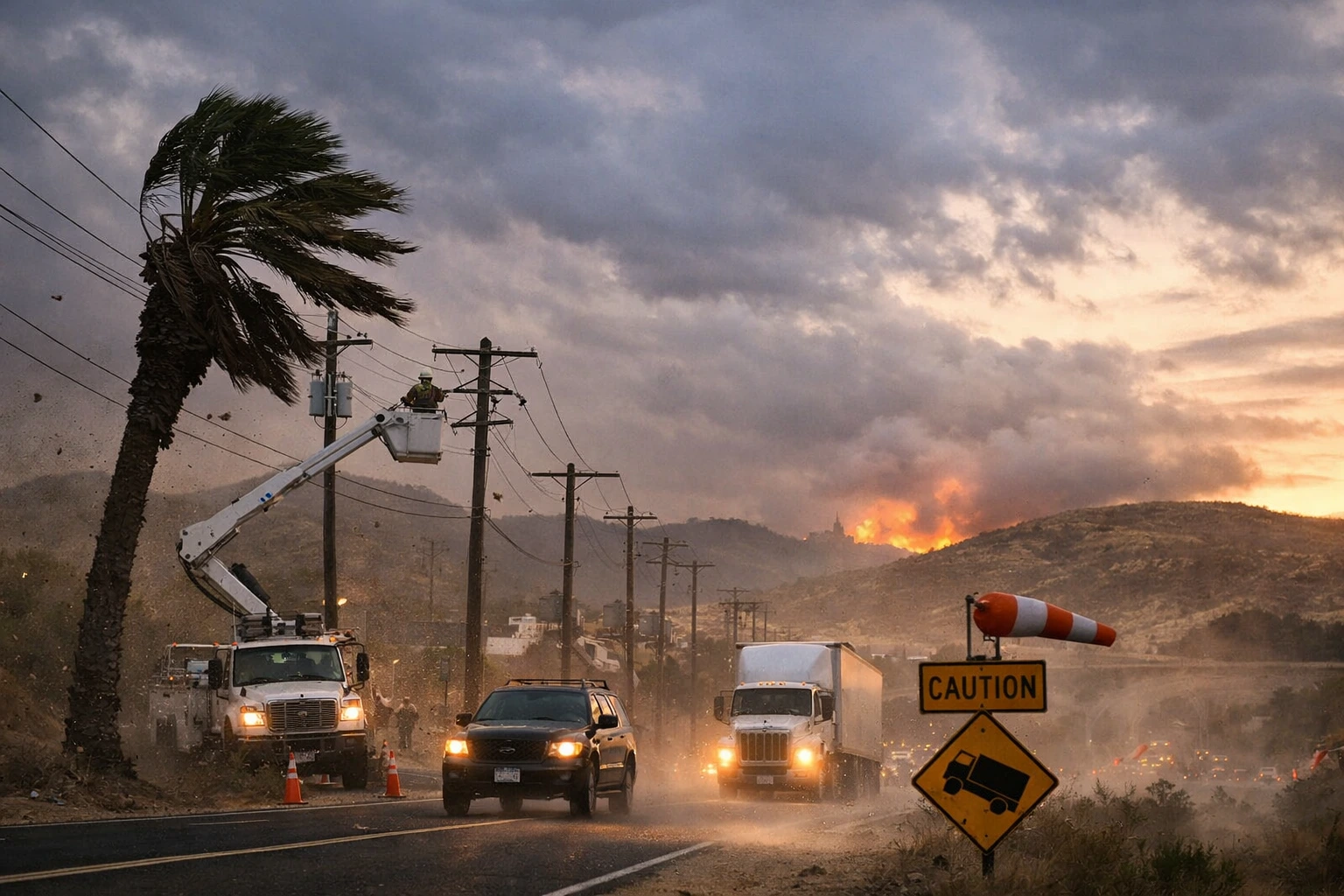
- Gusts up to 55 mph may cause minor power outages and hazardous driving conditions.
- Officials warn of elevated fire weather conditions in dry inland and mountain areas.
LOS ANGELES — A wind advisory affecting Southern California will take effect Monday morning, with forecasters warning that southwest winds of 20 to 30 mph and gusts reaching 55 mph could disrupt travel, down tree limbs and increase localized fire risk across coastal and inland communities.

The advisory was issued Saturday by the National Weather Service and will remain in effect from 6 a.m. to 6 p.m. Monday.
It covers a broad stretch of the region including Los Angeles County, Ventura County, Santa Barbara County and San Luis Obispo County.
While not classified as a high wind warning, the wind advisory affecting Southern California signals conditions strong enough to create safety concerns for motorists, utility providers and emergency responders.
The advisory spans coastal beaches, mountain ranges and interior valleys, including the Santa Monica Mountains, Santa Ynez Mountains, Santa Lucia Mountains, San Fernando Valley and Antelope Valley.
Forecasters said the strongest gusts are expected in elevated terrain and wind-prone passes, where funneling effects can intensify speeds beyond general forecasts.
Southern California frequently experiences advisory level wind events during transitional winter months, particularly when offshore pressure gradients strengthen.
These wind episodes can compound existing drought conditions, increase wildfire spread potential and place strain on aging infrastructure.
According to meteorological data from the weather service, advisory level winds in the region typically range between 35 and 55 mph. High wind warnings are issued when sustained winds exceed 40 mph or gusts surpass 58 mph.
Historically, similar wind advisories have led to scattered outages and traffic disruptions but limited structural damage. In recent years, however, emergency managers have taken a more proactive stance due to the growing intersection between wind events and wildfire risk.
Rose Schoenfeld, a meteorologist with the weather service’s Los Angeles forecast office, said the system is being driven by a tightening pressure gradient between the Pacific coast and interior desert regions.
“This is a fairly typical southwest wind event for February, but gusts approaching 55 mph can still create hazardous travel conditions, especially for high profile vehicles,” Schoenfeld said. “Mountain passes and coastal ridgelines will likely experience the strongest impacts.”
Officials with the California Department of Forestry and Fire Protection said dry vegetation in parts of inland Southern California means even short duration wind events require monitoring.
“While humidity levels are not critically low, wind speeds in this range can increase the rate of fire spread if an ignition occurs,” said Daniel Berlant, deputy director of community wildfire preparedness for the agency. “We encourage residents to avoid activities that could spark fires during peak wind hours.”
Utility providers are also monitoring the wind advisory affecting Southern California. A spokesperson for Southern California Edison said crews have been placed on alert in wind-prone corridors.
“Gusty winds can cause branches or debris to contact power lines,” spokesperson Gabriela Ornelas said. “We have inspection and response teams staged to address any outages quickly.”
In Ventura County, emergency officials said they are coordinating with transportation departments to monitor key roadways.
“We’re particularly watching elevated routes and canyon roads where crosswinds can be unpredictable,” said Andrew Dowd, a spokesperson for the Ventura County Fire Department. “Drivers of trucks, vans and recreational vehicles should use extra caution.”
Local residents are also preparing. Maria Hernandez, who lives in the Santa Clarita Valley, said she secured patio furniture and outdoor decorations after receiving weather alerts on her phone.
“We’ve had winds before that knocked over fences,” Hernandez said. “It’s better to tie things down early than deal with damage later.”
Motorists are advised to keep both hands on the steering wheel and reduce speed in gust prone areas.
Forecasters expect winds to gradually diminish Monday evening as the pressure gradient weakens. No additional advisories have been announced beyond the current timeframe, though meteorologists said updated statements could be issued if conditions intensify.
Seasonal outlook models indicate that Southern California may continue to experience periodic wind events through early spring, particularly in coastal and mountain regions.
The wind advisory affecting Southern California underscores the region’s vulnerability to short duration but high impact weather events.
While the forecast does not currently meet high wind warning criteria, officials emphasize that gusts up to 55 mph are strong enough to disrupt travel, damage unsecured property and elevate localized fire risk.
Authorities are urging residents to take precautionary measures ahead of Monday’s peak winds and to monitor official updates as conditions evolve.


