
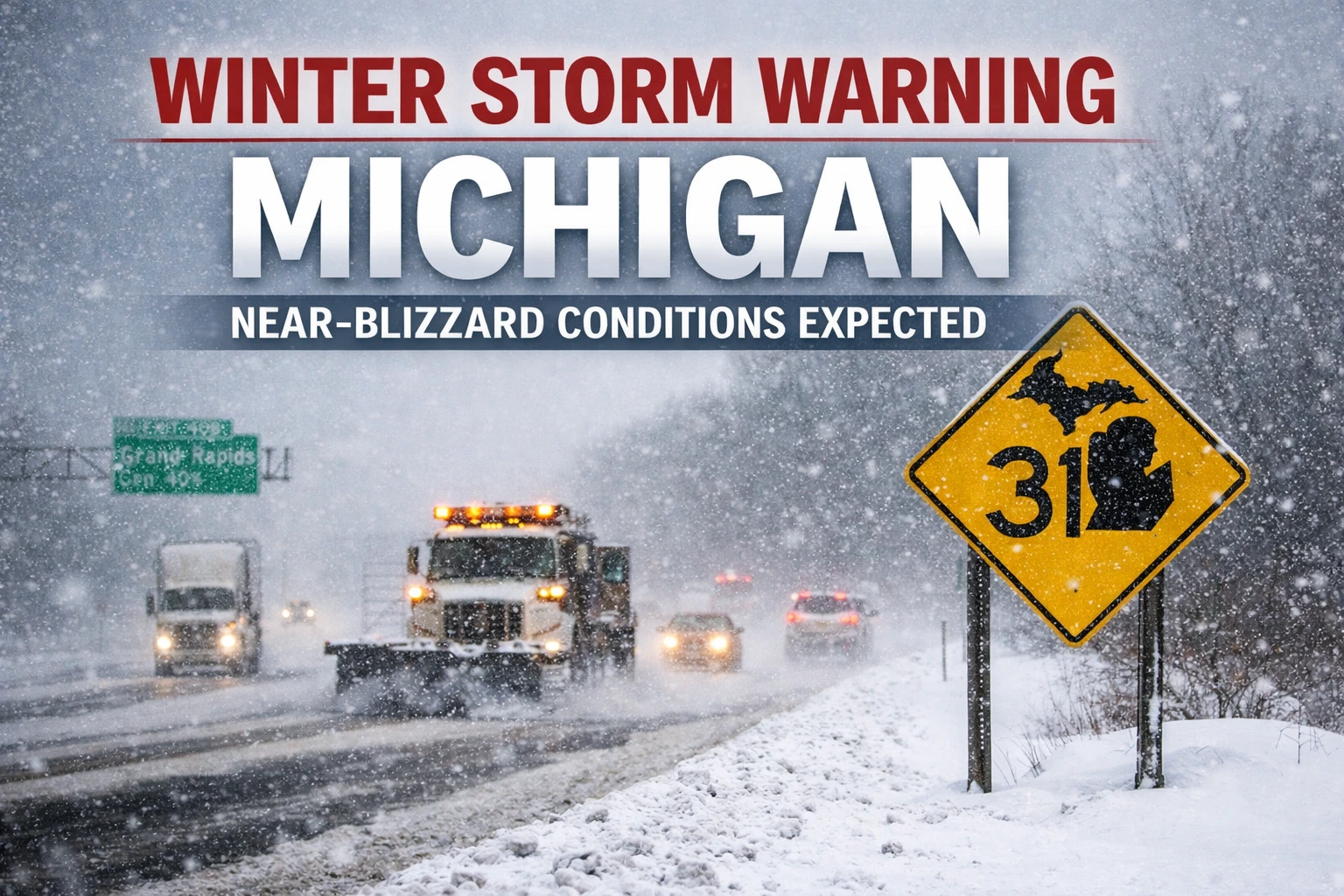
A winter storm warning has been issued for 23 counties across Michigan, with forecasters warning that near-blizzard conditions could develop from Monday afternoon into early Tuesday as heavy snow, strong winds and sharply reduced visibility threaten travel, public safety and regional infrastructure.
KEY POINT
- A winter storm warning now covers 23 Michigan counties as conditions intensify.
- Near-blizzard conditions could sharply reduce visibility and disrupt travel.
- Areas east of the warning remain under a winter weather advisory with lighter snowfall.
State and federal forecasters upgraded an earlier winter storm watch to a winter storm warning early Monday after confidence increased that a powerful winter system will deliver a combination of heavy snowfall, sustained winds and blowing snow across a large portion of Michigan.
The warning signals a higher likelihood of dangerous conditions capable of rapidly paralyzing transportation networks and straining emergency response capacity.
The storm is expected to arrive during a high-impact window, coinciding with afternoon and evening travel across both urban corridors and rural road networks, raising the risk of accidents, delays and temporary closures.
Michigan is no stranger to severe winter weather, but forecasters note that this system stands out due to its wind intensity and duration, which elevate the threat beyond routine snowfall.
Winter storm warnings are reserved for events that pose a clear risk to life and property, particularly when snow accumulation is paired with strong winds capable of producing near-whiteout conditions.
The affected counties span multiple forecast zones, reflecting the storm’s broad footprint rather than a narrow lake-effect event.
Areas immediately east of the warning remain under a winter weather advisory, indicating accumulating snow and slick roads but with lower wind speeds and reduced blowing snow compared with the warning area.
Meteorologists say the storm’s impact will be driven less by extreme snowfall totals and more by wind-driven visibility loss, a factor that often leads to the most dangerous travel conditions.
“When snow is falling steadily and winds increase, visibility can drop very quickly, even if total accumulation is moderate,” said a National Weather Service meteorologist.
“That combination is what creates near-blizzard conditions and makes travel particularly hazardous.”
Emergency management officials emphasized that blowing and drifting snow could make plowed roads impassable within minutes, complicating response times for law enforcement, medical services and utility crews.
Transportation analysts also noted that commercial trucking and regional supply chains could see delays, particularly along interstate routes that cross open farmland where wind exposure is greatest.
Local officials urged residents to take the warning seriously and avoid unnecessary travel once conditions deteriorate.
“The biggest concern is visibility,” said a county emergency management director in western Michigan. “People can become disoriented very quickly when blowing snow reduces sightlines, especially on rural roads.”
A road commission supervisor said crews will focus on priority routes but warned that drifting snow may limit how effective plowing can be during peak wind periods.
“There are times when it is safer for equipment to pull back until conditions improve,” the supervisor said. “That can surprise drivers who expect roads to stay clear.”
Residents in warning areas reported stocking vehicles with blankets, flashlights and extra phone chargers, reflecting heightened awareness after several recent winters marked by rapid weather changes.
Forecasters expect the most intense conditions to occur from late Monday afternoon through early Tuesday morning before gradually easing as the system moves east.
While snowfall rates are expected to decline, lingering blowing snow and cold temperatures could keep road conditions hazardous into Tuesday.
Officials said additional advisories or extensions remain possible depending on how long strong winds persist.
School districts and local governments are monitoring conditions and may adjust schedules or services if visibility drops faster than expected.
The winter storm warning for 23 Michigan counties highlights the seriousness of the approaching system, with near-blizzard conditions posing a substantial risk to travel and public safety.
While snowfall totals alone may not be historic, the combination of wind, blowing snow and reduced visibility underscores why forecasters elevated the alert level.
Authorities continue to stress preparation, caution and close attention to official updates as the storm unfolds.


