
KEY POINT
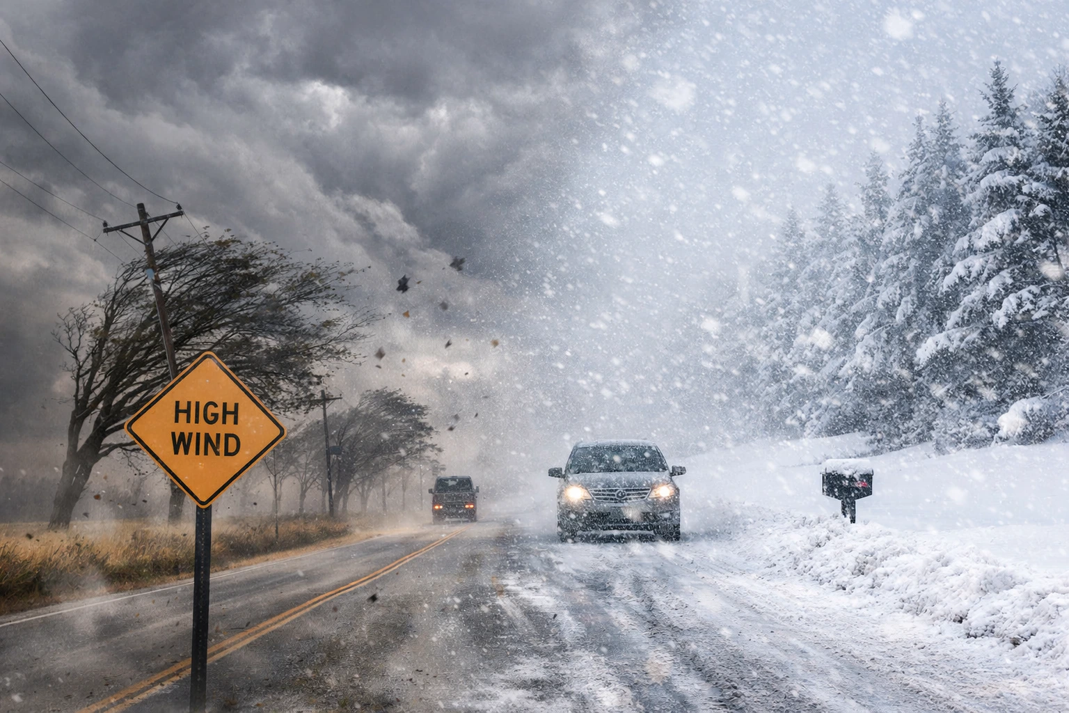
- Southern Wisconsin faces 60 mph wind gusts Friday under a high wind warning as a fast moving weather system moves through the region.
- A major Midwest winter storm beginning Saturday night could bring at least six inches of heavy snow to many areas.
- Areas north of the freezing line are expected to see continuous snowfall through the weekend, while southern locations may initially experience rain or a rain snow mix.
A high wind warning and an approaching winter storm are expected to impact parts of the US Midwest beginning Friday, bringing powerful gusts and the potential for significant snowfall across southern Wisconsin and nearby regions.
Meteorologists say strong winds could reach up to 60 mph Friday before a larger system arrives over the weekend that may drop heavy, wet snow across the region including areas near Chicago and northwestern Indiana.
Meteorologists across the Upper Midwest are warning residents to prepare for a two-stage weather event that could disrupt travel and daily routines across southern Wisconsin.
The first phase arrives Friday in the form of strong winds driven by a fast moving “clipper” system moving eastward across the Midwest.
The second phase is expected over the weekend when a much larger winter storm moves across the region, potentially producing heavy snow across southern Wisconsin and nearby metropolitan areas.
Weather officials say the system’s exact track will determine how much snow falls and where the heaviest accumulations occur.
Communities across the region including parts of Midwestern United States are closely monitoring forecasts as the storm approaches.
Clipper systems are fast moving winter storms that typically originate in western Canada and travel southeast across the northern United States.
While they usually produce lighter precipitation compared with larger winter storms, they can generate strong winds and sudden temperature shifts.
According to meteorologists, the clipper expected Thursday night into Friday will bring a light rain and snow mix before shifting eastward. The more significant concern during this period is wind.
Forecast models indicate sustained gusts approaching 60 mph in parts of southern Wisconsin from early morning through midafternoon Friday.
High wind warnings are typically issued when gusts above 58 mph are expected, conditions that can down tree branches, damage power lines and make driving hazardous for high profile vehicles.
After the clipper passes, attention shifts to a larger winter storm forecast to track through the Midwest beginning Saturday night.
Current projections place the storm’s path near the Chicago and northwestern Indiana corridor, positioning southern Wisconsin within a region favorable for heavy snowfall.
Meteorologists say the storm’s freezing line will play a critical role in determining precipitation type and total snow accumulation.
“The exact placement of the freezing line will determine whether communities start with rain, a rain snow mix or immediate snowfall,” said Dr. Victor Gensini, professor of atmospheric sciences at Northern Illinois University, who studies severe weather and winter storms.
Areas north of that line are expected to experience snow for most of the weekend, while regions farther south could see rain initially before colder air arrives Sunday.
Heavy wet snow could increase the risk of tree damage and power outages, particularly if strong winds persist.
“Wet snow carries much more weight than dry powder,” said Jennifer McNatt, a meteorologist with the National Weather Service in Milwaukee. “When combined with wind, it can put stress on power lines and tree limbs.”
The storm also arrives during a transitional period of the season when temperature swings can complicate forecasts.
Late season winter storms often produce wide variations in snowfall totals over short distances due to fluctuating temperatures at the surface.
Local officials and residents are preparing for the storm’s potential impact.
“Public works crews are already reviewing equipment and staffing in case the snow totals increase,” said Tom Novak, operations supervisor for a municipal public works department in southern Wisconsin.
“Heavy wet snow takes longer to clear and can be tougher on plows.Transportation authorities are also warning drivers to prepare for rapidly changing road conditions through the weekend.
“Wind Friday could make travel difficult even before the snow arrives,” said Kevin Malone, spokesperson for a regional transportation agency. “Drivers should allow extra time and monitor weather updates.”
Forecast models will continue to evolve over the next twenty four to forty eight hours as meteorologists refine the storm track and temperature profiles.
Even small shifts in the system’s path could significantly affect snow totals across southern Wisconsin and neighboring states.
Weather agencies are expected to update advisories and potential winter storm warnings as the system approaches Saturday night.
Officials are urging residents to monitor forecasts, prepare for possible travel disruptions and remain alert to changing weather conditions through the weekend.
The combination of powerful winds Friday and a potentially significant winter storm over the weekend could create challenging conditions across southern Wisconsin and parts of the Midwest.
While snowfall totals remain uncertain, forecasters say the region should be prepared for heavy wet snow and strong winds that may disrupt transportation and infrastructure through Sunday.


