
KEY POINT
- Severe storms in Bloomington caused property damage and power outages but no reported injuries.
- The National Weather Service issued a high risk tornado warning for Monroe County.
- More than one thousand eight hundred residents lost power during the storm.
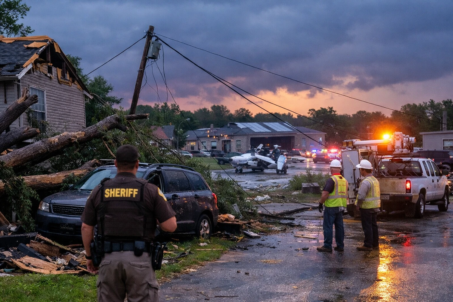
BLOOMINGTON, Ind. — Severe storms moved through Bloomington and Monroe County on Thursday night, triggering tornado sirens, widespread property damage and power outages after the National Weather Service issued a tornado warning describing conditions as a “particularly dangerous situation.”
The severe storms in Bloomington disrupted communities across Monroe County late Thursday, underscoring the growing intensity of severe weather patterns in the US Midwest.
Emergency officials reported structural damage, downed trees and power lines as residents responded to urgent warnings of a potentially large tornado.
The National Weather Service issued the tornado warning at 7:01 p.m. Eastern Time, citing radar indications of a large and dangerous tornado near Bloomington. Such warnings, often reserved for the most severe threats, signal an elevated risk to life and property.
Monroe County, located in southern Indiana, has experienced periodic severe weather events, particularly during seasonal transitions when warm and cold air masses collide.
However, local officials indicated that the intensity and rapid development of Thursday’s storms reflected increasingly volatile weather conditions seen across parts of the Midwest in recent years.
The storm system intensified as it moved into neighboring Greene County, contributing to additional power outages and raising concerns about broader regional impacts.
Meteorologists say such storm systems are becoming more complex and harder to predict with precision.
“Warnings labeled as ‘particularly dangerous situations’ are relatively rare and indicate strong confidence in severe impacts,” said Dr. Karen Mitchell, a senior atmospheric scientist at the National Oceanic and Atmospheric Administration.
“These events require immediate public response because conditions can deteriorate very quickly.”Emerqgency response experts emphasized infrastructure vulnerability during such events.
“Localized damage to power grids and residential structures highlights the need for resilient infrastructure planning,” said James Holloway, director of emergency management policy at the Federal Emergency Management Agency. “Even when injuries are avoided, the economic and logistical impacts can be significant.”
Jeff Brown, spokesman for the Monroe County Sheriff’s Office, said deputies responded to multiple damage reports across Bloomington’s west side.
“Just reports of property damage including homes, trees and power lines,” Brown said. “At this time, we have no reports of injuries.”
Local resident Angela Carter, who lives near the Highland Village area, described the storm’s intensity.
“The sirens went off and within minutes the wind was so strong we could hear things hitting the house,” Carter said. “We stayed in the basement until it passed.”
Officials noted that early warnings and public compliance likely helped prevent injuries.
Weather authorities continue to assess storm damage while monitoring for additional severe weather risks in the region.
Utility crews are working to restore power, and emergency management teams are conducting damage surveys to determine whether a tornado touched down.
The National Weather Service is expected to release further analysis, including storm path data and wind speed estimates, in the coming days.
The severe storms in Bloomington highlight both the effectiveness of early warning systems and the persistent risks posed by extreme weather events.
While no injuries were reported, the damage and outages reflect the ongoing challenges communities face in preparing for increasingly intense storm systems.


